 |
| Ground view of Ship Rock, which stands approximately 500 m above the surrounding land. The two main wall-like dikes can also be seen in this view. |
The peak elevation of Ship Rock is 7,178 feet (2,188 m) above sea level. The main part of the landform rises 1,583 feet (483 m) above the surrounding high desert in northwest New Mexico, a few miles southwest of the town of Shiprock (one word), New Mexico.
 |
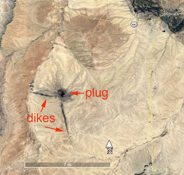
| Overview satellite image |
 |
| Medium-closeup image. |
The landform consists of fractured volcanic tuff breccia with subsidiary minette (lamprophyre) dikes. In addition, several wall-like sheets radiate (various distances) away from the central formation. Ship rock is a classic example of a diatreme volcano, or one that formed explosively from gas-charged magma escaping at great velocity.
 |
| Very closeup image. Scale is 1 mile. |
Ship Rock is one of more than 80 Oligocene to Miocene (about 28 to 19 million years old) volcanoes and intrusive features in the Four Corners (Utah, Colorado, New Mexico, and Arizona) region of the Colorado Plateau.
For a concise, yet detailed summary on the geology of this iconic landform, Google the phrase: "black rocks protruding up." You will be able to obtain a free pdf by Semken (2003).
The landform is sacred to the Navajo and is located on the Navajo Indian Reservation, which is private property.
No comments:
Post a Comment